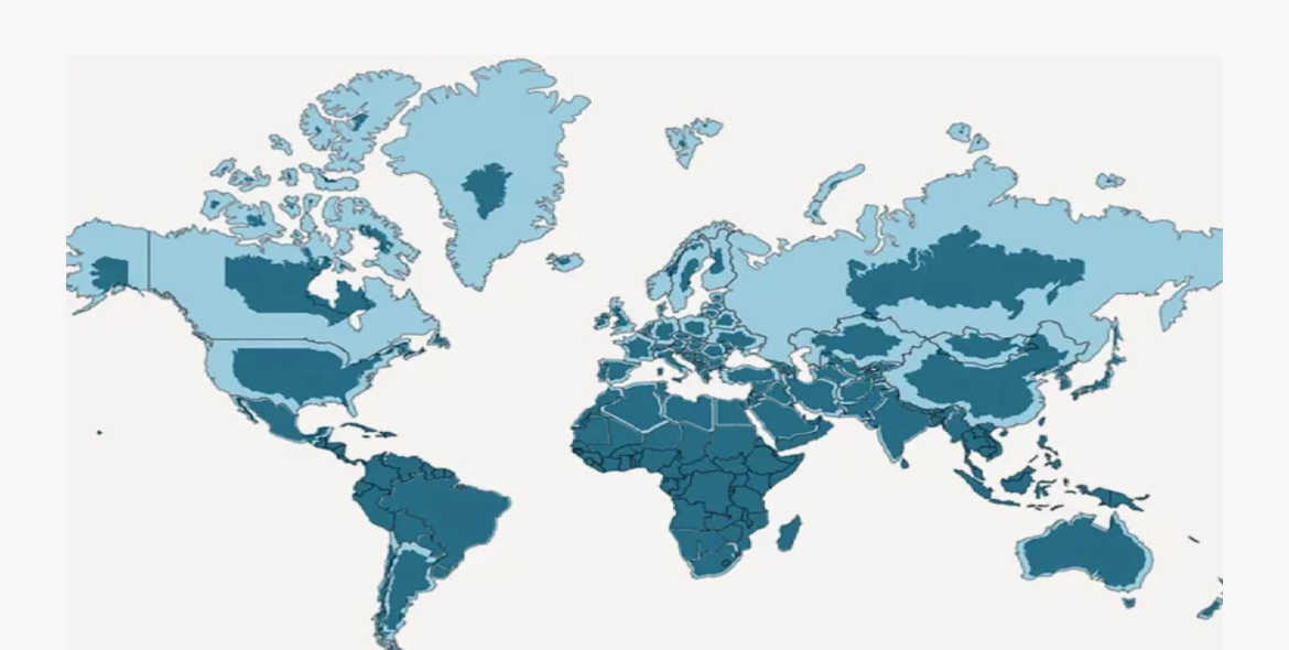
The UN General Assembly has voted 164–1 in favor of a resolution recommending the gradual phase-out of the traditional Mercator map projection in favor of cartographic designs that accurately portray the true sizes of countries and continents. The initiative, led by Togo with African Union support, passed despite opposition from the United States and six abstentions.
Togo highlighted that the Mercator projection—originally developed in 1569 for marine navigation—distorts geographic sizes by enlarging landmasses further from the Equator. This distortion created long-term educational and geopolitical biases, diminishing the perceived scale of Africa and the Global South; for example, showing Greenland nearly equal in size to Africa, which is actually 14 times larger.
While non-binding, the resolution is expected to drive shifts across educational curricula and digital mapping technologies. France has already committed to adopting the Eckert IV projection, while Togo plans to host a summit in Lomé during the first quarter of next year with UNESCO and tech giants like Google Maps to establish implementation strategies.